
If you have ever played golf, then you know that there are different types of clubs for different shots. When teeing off, golfers use a driver to give them distance. Along the fairway, they will reach for a wood or an iron. If the ball is stuck in a sand trap or a golfer needs a high arc to avoid a hazard on the course, a wedge comes in handy. And as they approach the green, golfers use a putter for accuracy at a shorter range. No single club is suitable for every situation, but taken together, they can help a golfer achieve the best possible score.
Remote sensing techniques work in a similar fashion.
Several different methods are available to assess properties for insurance purposes. No single method is perfect for every situation, and a certain level of expertise is required to select the most appropriate method from the range of tools available.
There are various companies utilizing remote sensing for property insurance, TensorFlight included. In this article, we aim to clear up some of the confusion around the use of remote sensing, explain how it compares to other methods of collecting property data, and explore what is possible today and in the not-too-distant future through emerging technologies.
Underlying Data Sources
TensorFlight automates the analysis of underlying data sources, including satellite imagery, oblique and ortho aerial imagery, Synthetic Aperture Radar, street view imagery, and Lidar. We use artificial intelligence (AI) and computer vision to extract relevant information from these sources. However, our analysis is dependent upon what imagery we can access. AI gives us a slight edge in analyzing those images, but AI is also limited by the source of the information. Even Skynet-level AI would not have the capacity to spot individual damaged shingles from a satellite image.
The frequency of data collection at the underlying source also serves as a constraint on any analysis. A photograph of a property which was taken a few months ago may not offer insight into the present state of that property. And of course, there is a cost associated with acquiring those images. We maintain relationships with many providers to obtain the best imagery possible for your use case. As noted above, different sources will be optimal depending upon your use case. TensorFlight’s final analysis merges several sources and perspectives. This sometimes entails an additional cost to access multiple sources of imagery, but it is well worth the investment.
Satellite Imagery
There are two primary satellite providers offering the highest available spatial resolution: 30-50 cm., which equates to one pixel on the image for every 30cm by 30cm of property (or a square foot). A single-family home in the U.S. averages 2500 square feet in area, so that translates to roughly 50 by 50 pixels in the satellite image. A higher resolution is technically possible, but regulations often prohibit that level of detail for commercial use.
Given the level of resolution, there are limits to what a user can glean from a satellite image. For example, you may be able to calculate footprint or roof geometry, but granular roof degradation will be hard to assess.
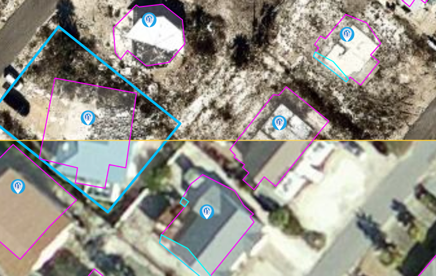
That said, satellite images are updated relatively frequently compared with some other sources. As a rule of thumb, an urban property will be photographed an average of once every three months, while rural properties are updated once every six months. In regions outside of North America, Europe, and Australia, each of those figures needs to be doubled. This means that any building information we utilize based on satellite imagery will likely be several months old.
Further, satellites typically provide a view from above the building, also known as NADIR. Based on this type of image, we can only give you information about the roof and surroundings (e.g., treetops). Some satellite images can offer a view of the façade if the image was taken at an angle. Sometimes, we can extract some basic facade information from this type of photograph, such as the number of stories to an apartment or office building.
Aerial Ortho Imagery
Aerial imagery is very similar to satellite imagery. Conceptually, you can think of it as being of a higher resolution than satellite imagery, but less frequently updated. The typical aerial image is collected via an airplane with a mounted camera and provides 10cm per pixel resolution. In North America and Australia, this type of imagery is widely available. However, these images are updated only half as frequently as that which can be obtained via satellite.

Availability in other regions varies by country but tends to be much poorer than in the United States. We maintain connections with several imagery providers in Europe, as well as in Japan and several other countries in Asia. However, in those regions the resolution may not be as clear, ranging as high as 30cm per pixel. Moreover, as noted above, the frequency with which the data is updated cannot compare with that of satellites. In many developing countries, aerial imagery is still not commercially available, and satellites are the only option.
Oblique Imagery
Oblique images are taken at a 45-degree angle from an airplane. This approach offers significant advantages, as we can view the building facade. It is possible to generate a relatively clear 3-D model of a property based upon oblique imagery. For example, we can use it to accurately compute attributes like the number of stories to a building, or to achieve greater precision around square footage. However, the coverage area for oblique imaging is sparse, primarily centered around larger metropolitan areas in developed countries. Additionally, this form of imaging is much more expensive than other sources. Nevertheless, it has a role to play in certain high-value, high population density residential and commercial markets.

Drone Imagery
Drones have the capacity to generate high resolution images, often down to mere centimeters per pixel, but we don’t utilize drone imagery. We see drones used in the property insurance market for one purpose – building inspectors and loss controllers may deploy one if they need additional overhead view during an onsite inspection. For other use cases, drones are subject to heavy regulatory requirements. It is expensive and cumbersome to even map a village using drones.

Street View and Property Imagery
There are several street-view providers who map areas using cameras mounted on cars. This method is superior for providing a close-up view of the property. From these photographs, we can discern the condition of the facade, the number of stories to a building, or even the type of material used in construction. However, not all street-view imagery is useful. Sometimes it is obscured by vegetation. Other times, the picture is taken too close or too far away from the building. Additionally, street views do not necessarily offer 360-degree imagery; when only the frontal image of a property is photographed, matching the right building can be challenging.
In addition to street-view, we sometimes obtain property photos from other sources, such as the real estate industry’s Multiple Listing Service or social media accounts. In addition to the external view of the property, it is sometimes possible to gain access to an internal view as well. For example, this enables us to confirm the construction type by examining the elements used.
SAR Imagery
SAR imagery is essentially radar derived from satellites. SAR stands for “Synthetic Aperture Radar.”
TensorFlight won a Spacenet challenge for recognizing buildings from SAR satellites: https://spacenet.ai/earthvision2020/.
The main advantage of SAR is its ability to pierce through cloud cover. For example, SAR can be used to quickly assess damages following a hurricane, even when airplanes cannot be flown due to windy conditions or clouds in the area.
Lidar ad Other 3-D Data
3-D building model data has several applications. As a first step, we generate an accurate 3-D model of the building. That, in and of itself, is a useful visualization for an underwriter. Based upon the 3-D model, we can then calculate several critical attributes, such as square footage, number of stories, roof pitch, and roof geometry.

Some buildings have complex shapes, like towers or varying heights of rooftops, and 3-D modeling offers us a higher degree of accuracy by taking these complexities into account. TensorFlight uses a range of Lidar sources. Some of these are freely provided by governments, while others are commercially available. In the U.S., this content covers about 80% of buildings. However, Lidar data is one to two years old on average. We also have access to Lidar in certain other countries, such as the U.K. or Canada.
Public Data Sources
Despite the availability of commercial outlets, we still sometimes need to draw upon public data sources. Geocoding and parcel information are some prime examples of this. The problem with public data is that it is supported by a multiplicity of local governments. In the U.S. alone, there are over 3,000 counties that export this data (indeed, some do not), and each applies its own standards and schedules to the process. The situation is similar in other countries. Thus, it is not possible to build a consistent, up-to-date, high coverage service relying solely upon this type of data.
Some of our older, more established competitors still build their service model around public data, and we think this is a mistake. It is the imaging equivalent of using a putter for every stroke in your golf game. A wider range of information gathering techniques is called for. However, we will use this data along with other methods of benchmarking the results of our AI process. Furthermore, in situations when our AI indicates two possible conclusions (such as with construction type), we will consult public data to make this determination.
Latency
By latency, we are referring to how quickly you will be able to receive the data after contacting us about a particular property. In some of our Service Level Agreements, our turnaround time can be as little as thirty seconds. Latency depends on the approach to data gathering, and more specifically, whether we utilize precomputing or “on-the-fly” analysis. Precomputing means that a company analyzes all imagery once and delivers previously computed results. Analysis on-the-fly means that we compute the data upon receipt of the address from our client. We primarily rely upon the on-the-fly method, but we also precompute some values. Each approach has benefits and drawbacks.
Pre-computing requires purchasing the imagery in advance. This entails an increased cost, as not all imagery is going to be utilized. It also means the data will be older, since it takes time before the image is incorporated into the pre-computing pipeline. In our industry, it is not unusual for building data to be three months older than the imagery upon which it is based. On the other hand, latency is improved; data can be returned in a matter of seconds.
Analysis on-the-fly naturally takes more time to compile, so the latency is increased. On the other hand, the data isn’t subject to the aging issues mentioned above. The commercial property market is our focus. For most use cases, thirty seconds is still sufficient. In a small commercial space, we can support online quoting and straightforward processing, since it will take more than thirty seconds for the insured to complete the questionnaire.
What is This Data Great For?
- Remote sensing is very useful for underwriting purposes since it aids in the general risk assessment for residential and commercial properties.
- Claims adjusters also utilize remote sensing to help quantify losses following weather events, fires, or other forms of property damage.
When is This Data Not for You?
Remote sensing is not helpful when you need very granular property information, such as distinguishing between construction types. For example, remote sensing techniques will not always be able to differentiate between ISO construction type, RMS construction type, or a customized classification. Some companies require more detailed classification of materials used in construction. In cases like this, you may wish to consider hiring a property inspector.
If you are looking to support residential property quotes and need a quote on a particular address in just a few seconds, our service may not be right for you.